Getmapping adds new, ultra high resolution data to G-SaaS platform
- stuartcattermole
- Mar 30, 2023
- 1 min read
As we continue to enjoy a fantastic flying season, we are capturing and processing huge volumes of up-to-date imagery, which have now been added to Getmapping's G-SaaS platform.
We have brand new 12.5cm and 25cm images for many areas across the UK, including this image of the Outer Hebrides for example.

Outer Hebrides, 2021
In addition to our latest 2021 12.5cm and 25cm content, we are capturing specialised, ultra high resolution 3cm vertical and oblique data sets for multiple urban areas. Data-sets for cities like Cambridge and Cardiff are available now on our GSaas platform.

Cambridge, 2021
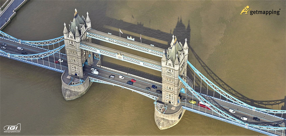
We also have new 10cm vertical and oblique imagery immediately available for the whole of Greater London. Oblique photographs are taken at an angle, and complement traditional vertical images to provide an ‘all around’ view of a building or landscape and unprecedented levels of detail, accuracy and clarity.

The Shard, London, 2021


Comments